RAILWAYS
Since 1990 ABA Surveying has grown to be one of the leading Land and Engineering Surveying Companies in the UK.
Our in-house planning capabilities (Safe System of Work Planner) and utilisation of Network Rail’s portal enable us to plan work more effectively, efficiently and safely, allowing us to request and book work sites, either our own or to co-ordinate shared access with others, if clashes have been identified. We continually liaise with our clients to assist with coordinating site access. ABA Surveying can prepare all levels of paperwork, for example, Risk Assessments. Work Package Plans (WPP), Task Briefing Sheets (TBS), Safe System of Work Packs (SSoW).
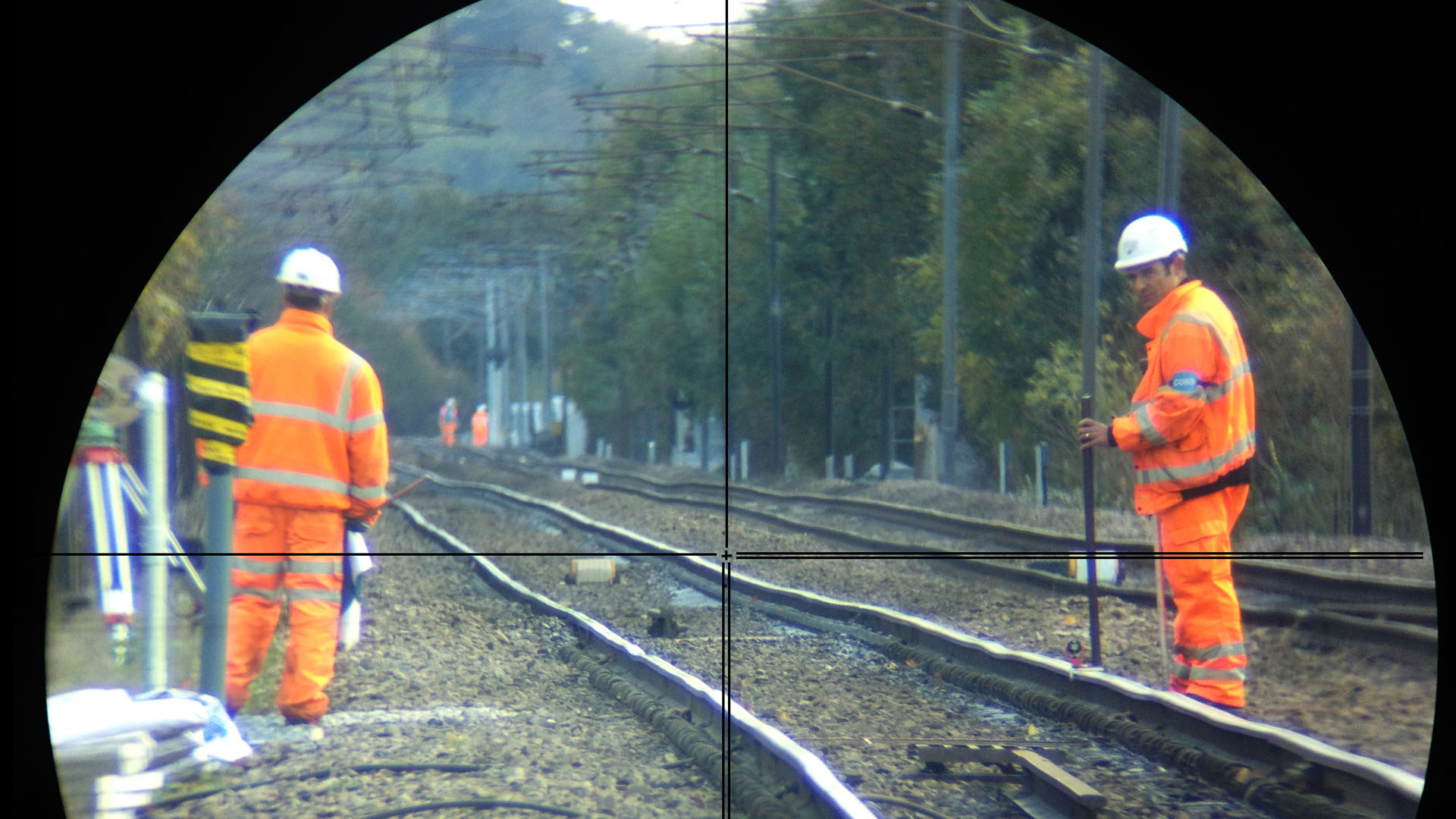
All Field Surveyors are PTS (NWR and LUL(TfL), CSCS and Confined Space certificated and our Senior Surveyors hold PC and COSS, SWL competencies. This benefits the client by removing the additional cost of protection staff, along with a preference being given to a line blockage over more costly possessions, further enhancing our value for money philosophy and commitment to get the most out of every shift.
We are committed to providing cost-effective, first-class survey solutions to the rail industry in combination with our highly experienced, qualified personnel and the very latest equipment available.
With over 25 years’ experience working on the railways we are thoroughly familiar with the challenges faced by our clients and are confident of successfully meeting all their surveying requirements.
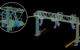
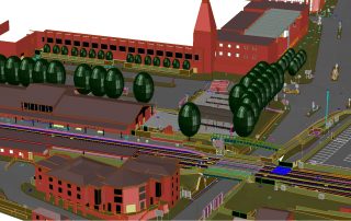
We survey all types of rail infrastructure, including Network Rail, TfL, LUL, DLR, Tram and Metro.
ABA Surveying have recently successfully completed the B2K (Bedford to Kettering) Survey for the MML Upgrade for Atkins and the Gospel Oak to Barking Upgrade Survey for Aspin.
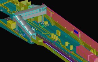
Track and Topographic Surveys
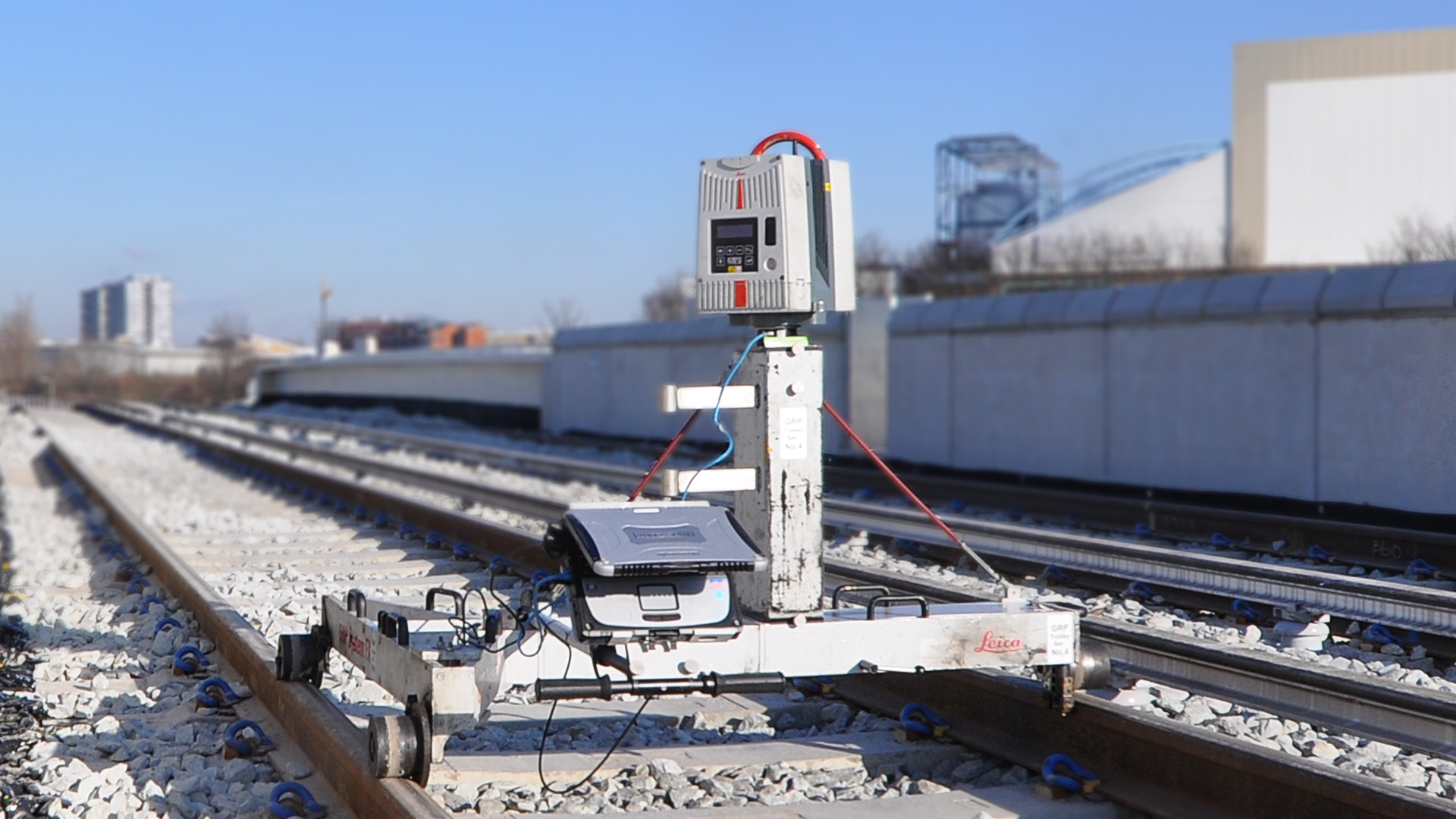
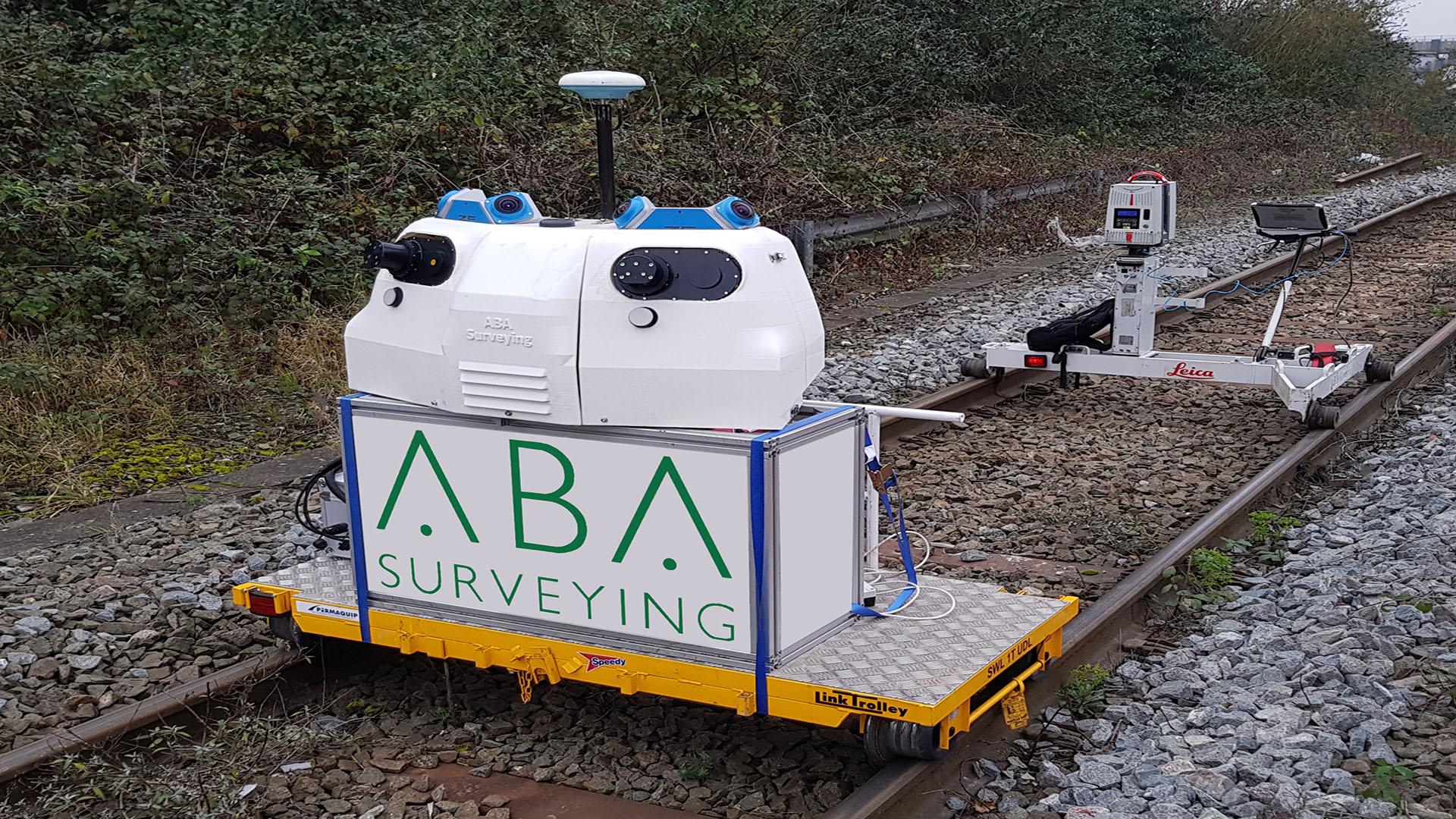
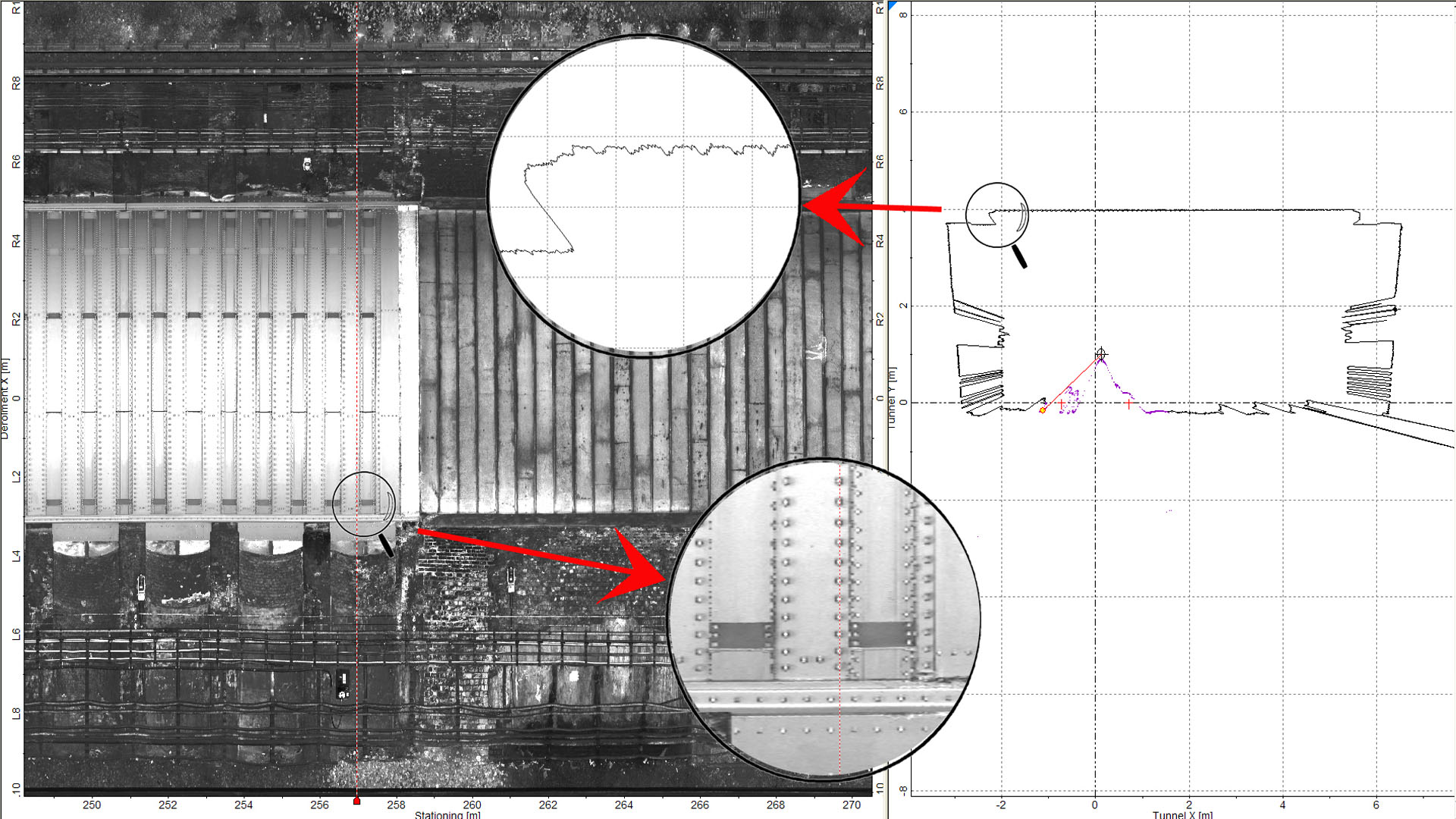
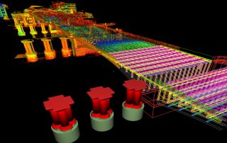
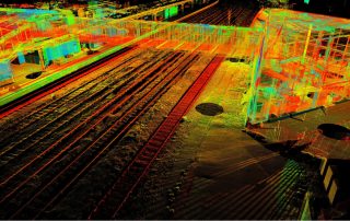
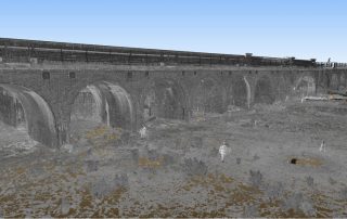
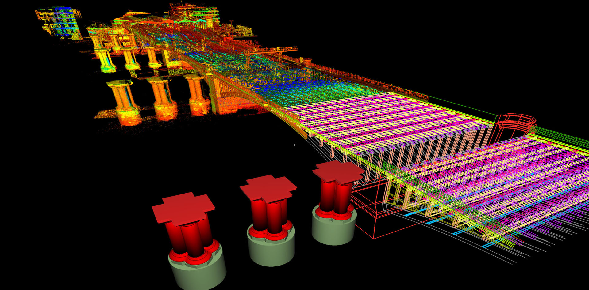
Our expertise ensures we offer unique solutions to the challenges that railway surveys throw up in the way of time and access constraints. Our use of remote data capturing equipment reduces costly line blockages and disruptions. Static Laser Scanning or the Amberg Track Trolley System (GRP5000) captures a complete database of the area. If any additional data is required, this can be extracted from the point cloud at a later stage, cutting out any future need for expensive and inefficient site revisits
With our three GRP track measuring devices our experienced surveyors can undertake track alignment surveys quickly and accurately to provide cant and gauge measurements along the length of the track. Specific details of permanent way such as signals, welds, switches and platform edges are recorded as per the client’s requirements.
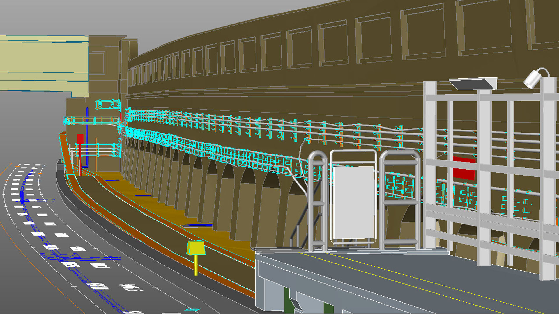
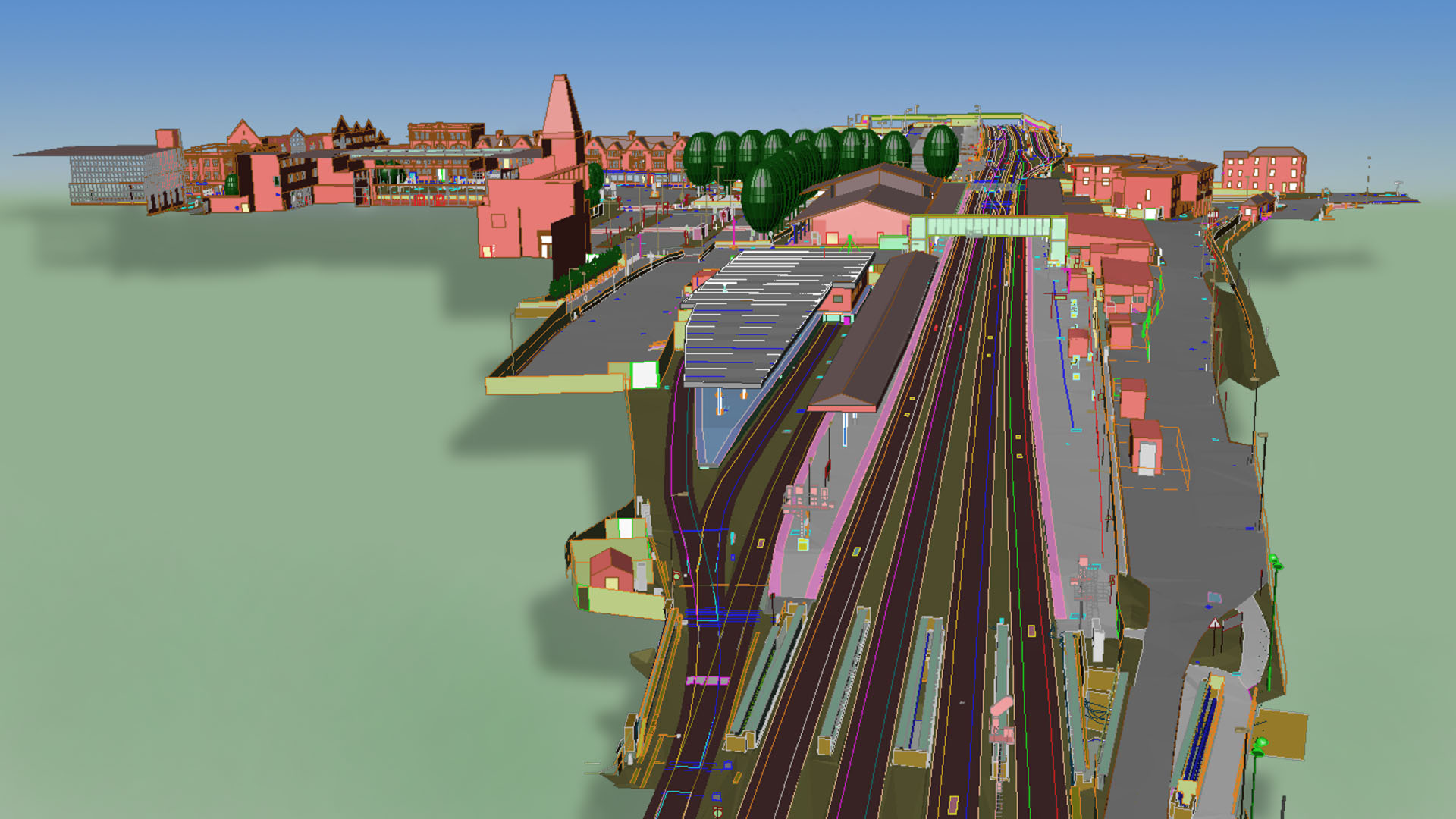
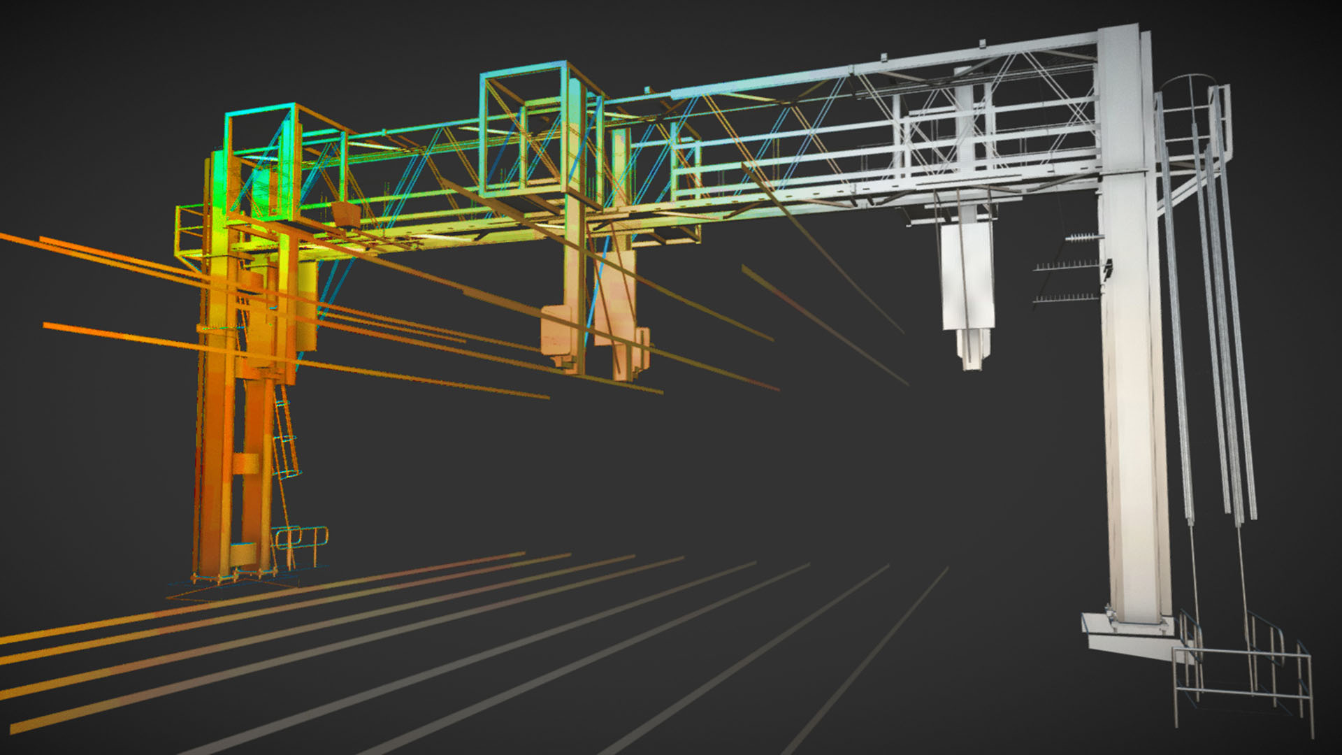
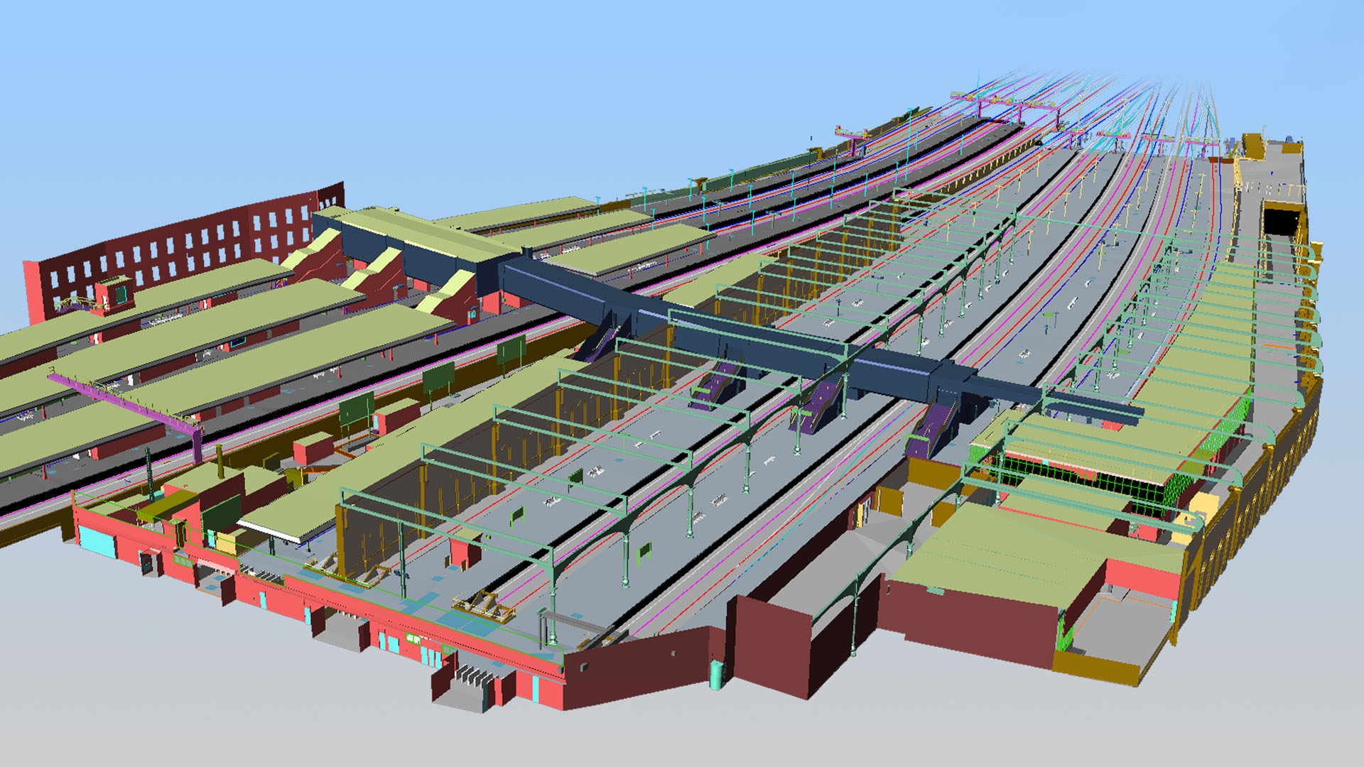
Deliverables can include 2D and 3D Topographic and Wireframe drawings, SC0 Gauging Data for ClearRoute™ and if required, full scale BIM models.