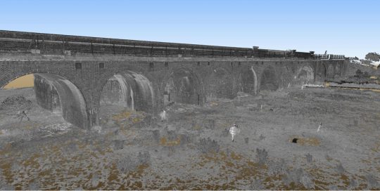
BLACKFRIARS BRIDGE Blackfriars Bridge, London Leica HDS4500 Leica ScanStation Total Station GRP5000 Rail Trolley 3D CAD Model Registered Point Clouds TruViews Railway Surveying is not just about tracks as we proved on the Thameslink Project. The Thameslink Programme was a huge project of track and infrastructure improvements. Asked to provide [...]
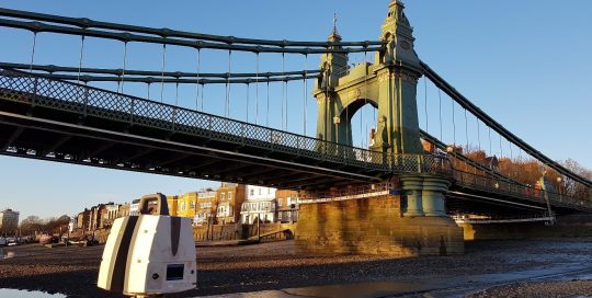
Hammersmith Bridge
Heritage, Laser Scanning, Structures
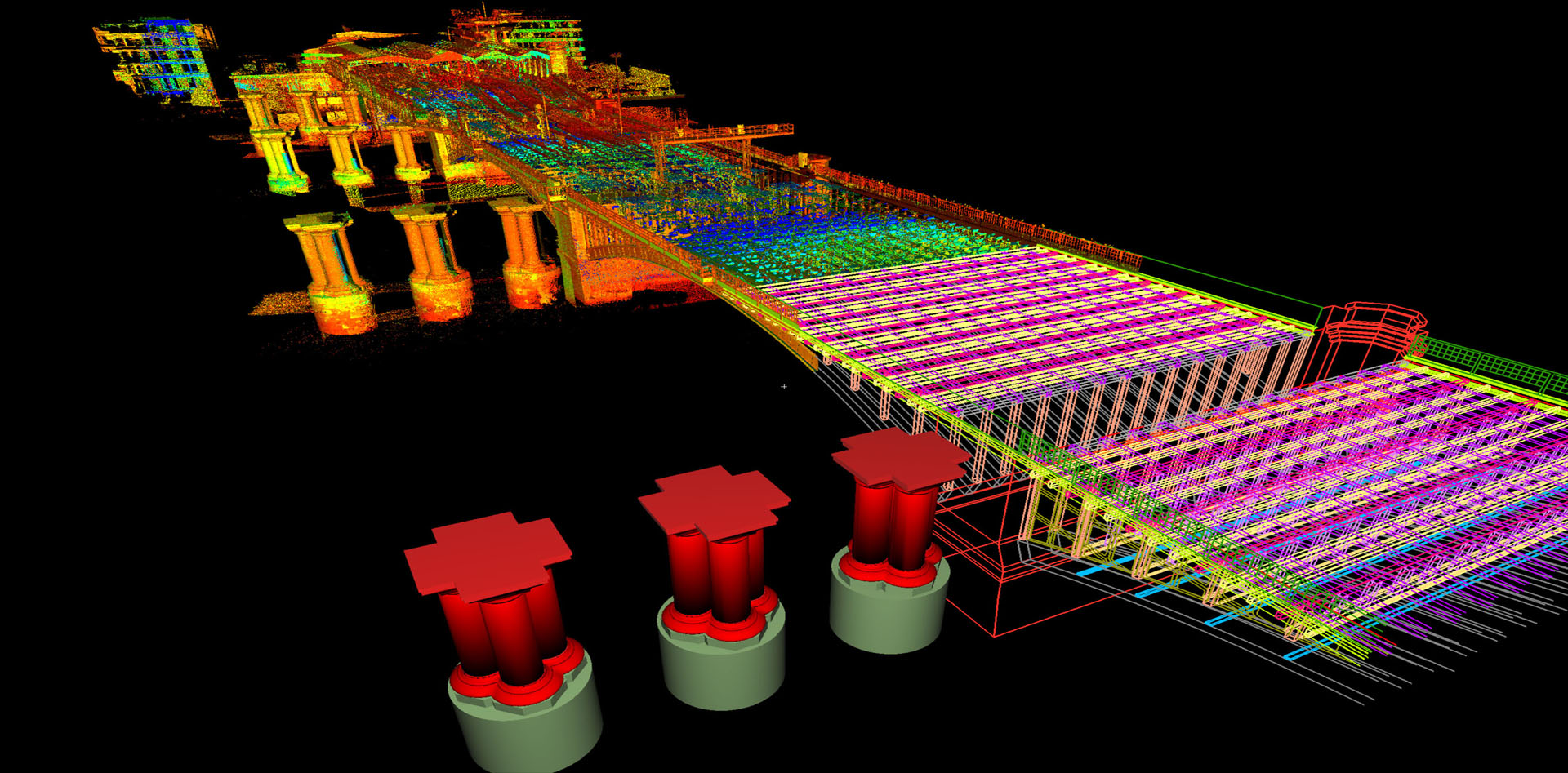
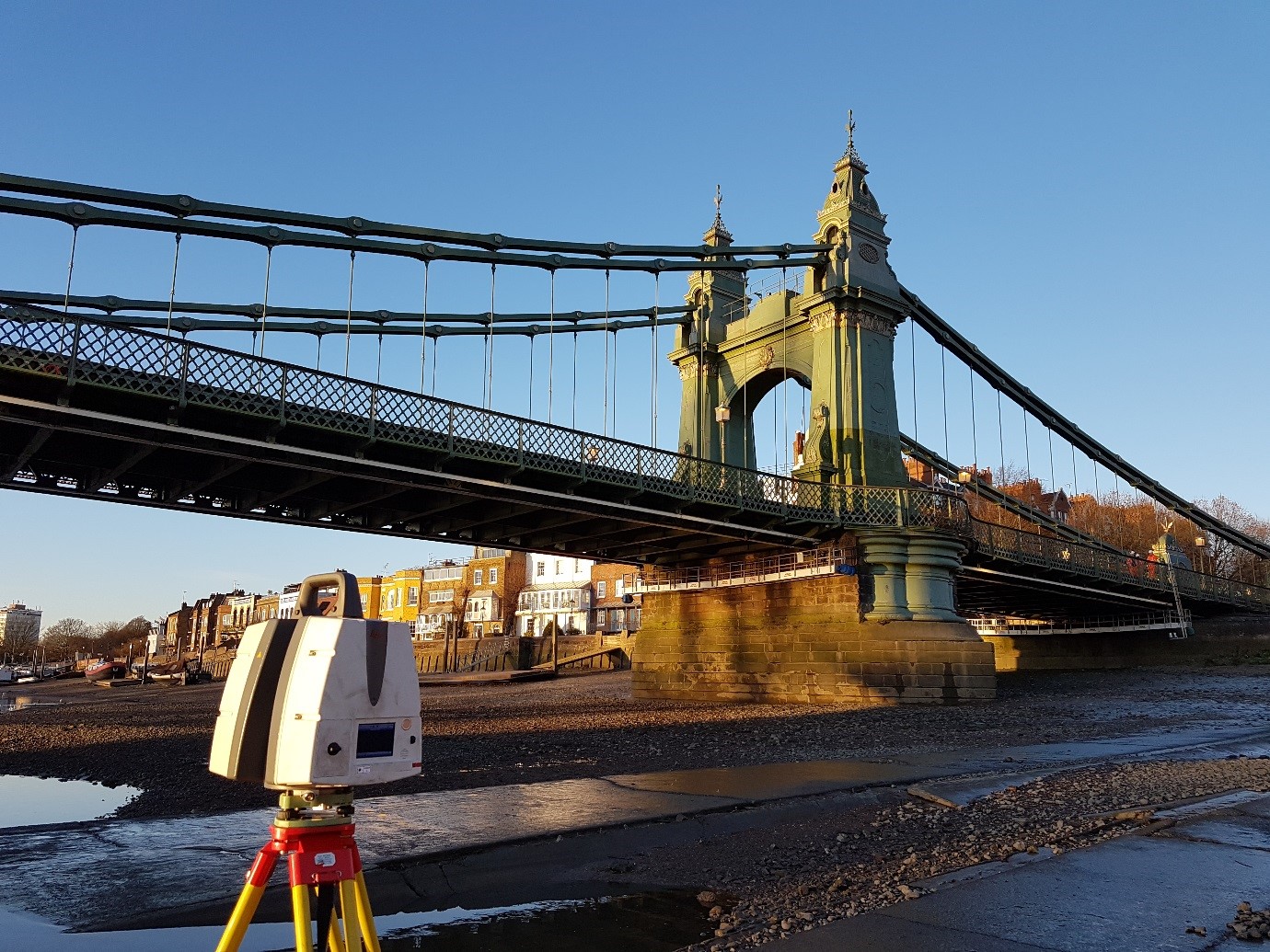
HAMMERSMITH BRIDGE Hammersmith, London Leica ScanStation P40 Total Station RECAP, PTS & E57 Colour Point Cloud Files Wireframe CAD Model Introduction Hammersmith Bridge was constructed circa 1887 and is a Grade 2* listed structure. It crosses the River Thames and consists of 3 spans making a total length of 223m. There [...]
Mary Rose Trust
Heritage
MARY ROSE TRUST Portsmouth, UK Leica HDS 6200 Total Station PTS Point Cloud File TruView In 2009 ABA Surveying was asked to scan and provide a 3D point cloud for the Mary Rose. Since the wreck had been raised from the bottom of the seabed of the Solent in 1982 it [...]
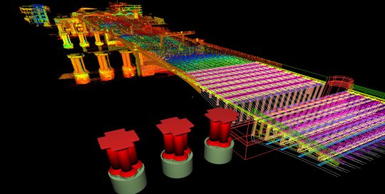
Derby Station Remodelling
BIM, Buildings, Rail, Structures
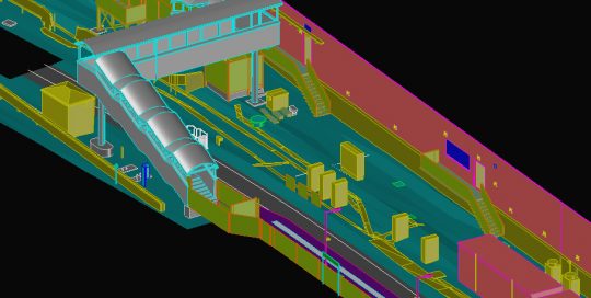
DERBY STATION REMODELLING Derby Railway Station, UK Leica P40 Scanner Total Station 3D CAD Model As part of the Derby Station remodelling programme there was a requirement for an as-built of a new footbridge. The bridge was scanned both externally and internally using a Leica P40 scanner and controlled by targets [...]
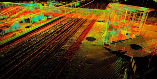
Midland Mainline Electrification
Air Survey, Infrastructure, Land Survey, Rail
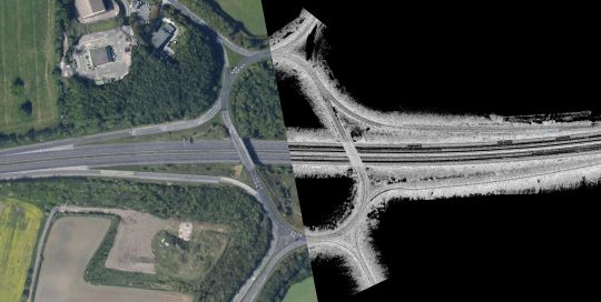
MIDLAND MAINLINE ELECTRIFICATION Bedford to Kettering, UK Leica P40 Scanner Total Station GPS Rail Trolleys Air Survey 3D Surface Model 2D Elevations TruViews Point Cloud Data Aerial Photography Gauging Data The survey for the Midland Main Line Upgrade between Bedford and Kettering involved the modelling of some 18 bridges and viaducts along [...]
Gospel Oak – Barking Electricification
Air Survey, Infrastructure, Land Survey, Rail, Structures
Gospel Oak - Barking Electricification Gosepl Oak - Barking, UK Air Survey Leica P40 Scanner Total Station GPS GRP Rail Trolley 3D Surface Model Gauging Data Aerial Photography This was a Network Rail project to electrify the line between Gospel Oak and Barking, a distance of some 20km, with 5km being [...]
M1 Smart Motorway
Asset Management, Highways, Mobile Mapping
M1 SMART MOTORWAY Sheffield, UK ABA Mobile Mapping Van 3x Leica HDS 6200 Scanners IXSEA IMU 3D CAD Model LSS Model Part of a 30km Survey of the M1 near Sheffield carried out with our mobile scanning system which involved 2 passes on each carriageway, plus all the slip roads and [...]
Natural History Museum
BIM, Buildings
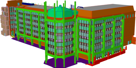
Natural History Museum Kensington, London, UK Leica P40 Scanner Total Station 3D BIM Model ABA surveying was contracted in 2013 to conduct a full 3D survey of the Palaeontology Building of the Natural History Museum. In contrast to the historic Waterhouse building, the modern Palaeontology Building had been built in the [...]
Panmon Project – Cheddington
Asset Management, Infrastructure, Rail, Structures
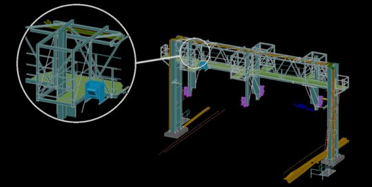
Panmon Project - Cheddington Cheddington, Buckinghamshire, UK Leica P40 Scanner 3D Surface Model The Panmon Programme was a Network Rail project to mount special cameras on selected gantry’s to monitor wear on the contact wire. This information can then be transmitted back over time to an office for analysis. These cameras are [...]

Oxford Corridor Project
Air Survey, BIM, Buildings, Highways, Land Survey, Rail, Structures
Oxford Corridor Project Oxford, UK Leica HDS 6200 GRP Rail Trolley Total Station GPS 3D CAD Models Gauging Data POD Files TruView The Oxford Corridor is a site of extensive capacity and performance investment in the railway network. In 2014 ABA was contracted by TATA Steel to survey Oxford Station, its [...]