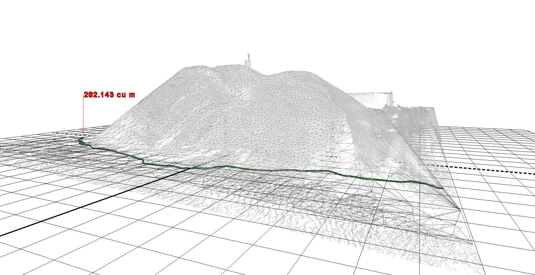
Volumetric Calculations
Utilising our specialist software we can produce volumetric calculations from our survey data. This could be field data collected by our traditional survey instruments (total stations & GPS), point cloud data collected by our terrestrial scanners or aerial photography and LIDAR.
Calculations can be performed for many different scenarios, for example:
- Surfaces over or under a certain level, i.e. mound of spoil or area of excavation.
- Accurate volumes of liquid within a container, such as a large storage tank.
- The volume between two superimposed surfaces, such as as-built compared to design.